Before You Commit Capital to a Wildcat, Get One More Signal on the Ground.
Independent well-location assessments for operators, investors, and landowners. Oil work across seven states. One defined deliverable.
We are not hiring. This site is for exploration clients only. Thompson Well Location has no job openings and does not accept job applications.
† helped across Rob Thompson's dowsing career
The Math of a Dry Hole
A wildcat is a bet placed outside proven production. Most exploration budgets live or die at the location decision — everything downstream inherits it.
The Most Expensive Way to Be Wrong
A dry wildcat returns nothing but information. Lease, permitting, rig, and crew capital is spent whether or not the location was right.
Everything Inherits the Location
Choose the location and you've chosen the lease block, the permit path, the pad, and the odds. No decision downstream can fix the one made first.
Thin Data, Big Bet
By definition, a wildcat sits where offset well data is scarce or absent. Every additional independent signal — cheap relative to the decision — has asymmetric value.
An Independent Signal, Before Spud
Thompson Well Location gives decision-makers one more input before capital is committed: an independent read on whether oil is present, where the field sits, how much land holds it, and where to stake candidate drill sites. You weigh it against your geology, your seismic, and your economics — at a fraction of the cost of any of them.
What Rob Does — Plainly
Rob Thompson locates oil by dowsing. He is the third generation of his family to do this work: his grandfather, Walter Thompson, was a working oil wildcatter who located fields and wells across California and Nevada the same way. Rob has dowsed since 1978, spent ten years co-owning one of the largest water well drilling companies in Northern California — standing on drill sites, accountable for what came out of the hole — and is a licensed engineering contractor. Over the last decade he has carried the family practice onto oil ground across seven states.
Is dowsing controversial? Yes — and Rob will tell you that himself.
“Dowsing is not an exact science. It’s an art that has worked for mankind for thousands of years before the study of science began.”— Rob Thompson
He's in reasonable company on the question:
“I know very well that many scientists consider dowsing as they do astrology, as a type of ancient superstition. According to my conviction, this is, however, unjustified. The dowsing rod is a simple instrument which shows the reaction of the human nervous system to certain factors which are unknown to us at this time.”— Albert Einstein
Rob doesn’t ask you to believe anything. He asks for a map.
You’ll weigh his findings the way you’d treat any independent signal — against your geology, your seismic, and your economics.
From Land Signal to Drilling Decision
A defined four-stage engagement. Each stage has a concrete output, and each stage is a decision point — you commit to the next step only when the last one earns it.
Remote Map Review
Send a physical map of the acreage. Using a large-screen Google Earth mapping system, Rob assesses remotely whether oil is present — before anyone books travel.
Output: Go / No-GoField Location
On site — "boots on the ground" — Rob locates the boundary of the oil field or stream and logs it with GPS and Google Earth, including how much land to lease to hold the whole structure.
Output: Field Boundary + Lease GuidanceSite Staking
Candidate drill locations staked on the ground within the field, each recorded with GPS coordinates.
Output: Staked Sites + CoordinatesThe Location Report
Depth assessment, barrels-per-day assessment, a 1–10 crude quality grade, coordinates, and Google Earth overlays — delivered as a document.
Output: Wildcat Location ReportWhat You Actually Receive
Every engagement ends in the same place: a Wildcat Location Report your team can carry into its own diligence. No vibes — a document.
GPS-Staked Drill Sites
Each candidate well location staked in the field and recorded with GPS coordinates.
Field Boundary Map
The assessed extent of the oil field or stream, overlaid on Google Earth — so you know how much land to lease to hold it.
Depth Assessment
Rob's field assessment of total well depth at each staked location.
Production Assessment
Rob's field assessment of expected barrels per day at each site.
Crude Quality Grade
Each site graded on Rob's 1–10 oil quality scale — from heaviest grade to jet-fuel light.
The Written Report
Coordinates, maps, and assessments compiled into one document for your team and your partners.
The Thompson Quality Scale
Rob's 1–10 field grade for crude quality, assigned per site
Stated plainly: depth, production, and quality figures in a Wildcat Location Report are Rob Thompson's field assessments — not a geological survey, engineering evaluation, or investment advice. No assessment, by any method, can guarantee the presence, quantity, or quality of hydrocarbons.
Three Generations on the Ground
Walter Thompson found oil for a living. A wildcatter working California and Nevada, he located fields and wells by dowsing — in the era when wildcatting built the American oil industry.
Two generations later, his grandson Rob has dowsed since 1978 and spent ten years co-owning one of the largest water well drilling companies in Northern California. That decade wasn't theory: it was drill sites, drilling crews, and being accountable for what came out of the hole. A licensed engineering contractor and member of the American Society of Dowsers, Rob has carried the family practice onto oil ground for the last ten years — Texas, Nevada, Kansas, Nebraska, Wyoming, Louisiana, and California — helping more than 4,000 individuals and companies along the way.
His tools are dowsing rods, a physical map, GPS, and Google Earth. His deliverable is a report.
Some of it he can explain. Some of it he can only demonstrate.
Third Generation
Grandson of Walter Thompson, oil wildcatter of California and Nevada.
Dowsing Since 1978
More than four decades of location work, from water to oil.
Drilling Operator's Decade
Ten years co-owning one of Northern California's largest water well drilling companies.
Licensed Engineering Contractor
Holds an engineering contractor license; member, American Society of Dowsers.
Seven States of Oil Work
TX · NV · KS · NE · WY · LA · CA over the last ten years.
When the Wells Run Dry, the Press Calls Rob
National and regional press have followed Rob's location work for years — especially through California's droughts.
Two Rods and a ‘Sixth Sense’: In Drought, Water Witches Are Swamped
Amid California's drought, desperate landowners and managers turned to those who practice an ancient, disputed method for locating water.
Read the article → The Wall Street JournalRob’s Dowsing Practice, Profiled in the Journal
National business press took the same question to the field: how does a dowser keep finding what the instruments miss?
Read the article (subscription) → San Francisco ChronicleWater Witches in Demand as Wells Run Dry
"The calls started in October when the rain was supposed to come. Rob Thompson's phone kept ringing — a farmer in Fresno, a winemaker in Napa Valley, a rancher in Yreka."
Read the article → San Francisco Chronicle · ArchiveDowsers Get Lowdown on Water Spots: Sonoma County Man Has Nose for Underground Wells
A Chronicle profile of Rob's practice from the 1990s — the press has been following this work for nearly three decades.
Read the article → CBS News Bay AreaOld-Fashioned Dowser Uses Sixth Sense to Help Napa Farmer Find Water
CBS followed Rob onto a Napa farm as the drought pushed growers to look underground.
Watch / read → ABC7 San FranciscoAn Ancient Method to Find Water for New Wells Amid Drought
ABC7's cameras went out with Rob's rods as California's wells ran dry.
Watch / read →Also covered by the Los Angeles Times and the Press Democrat, plus CBS and ABC broadcasts.
“I’ve relied on him for many wells in many areas on the thousands of acres we farm… Rob has always come through for us.”— Mark Neal, President, Jack Neal and Son · vineyard management, Napa & Sonoma counties (water well location)
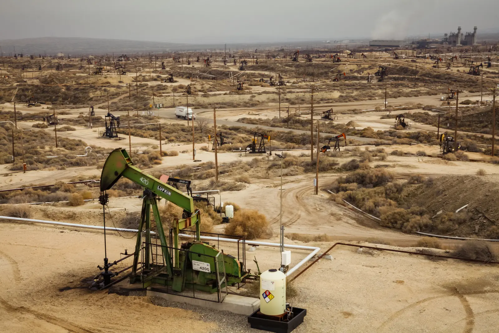
Lost Hills field, Kern County, California — pumpjacks at sundown
Watch Rob in the Field
Don't take the word of a website. Watch how map dowsing and field location actually work.
Map Dowsing, Demonstrated
How Rob works from a map before anyone books travel — the same first step as every Wildcat Review.
What Is Dowsing?
Rob explains the practice in his own words — no mystique, no hard sell.
On Working Land
Field location work for Northern California wineries — the discipline that carries over to oil ground.
Who This Is For — and Where the Line Is
A Wildcat Review is useful to a specific kind of decision-maker. Here's the fit, stated both ways.
Independent Operators
Fit You're selecting between prospects or locations before committing a program.
Boundary Rob won't re-run your geology — he brings an independent read to weigh against it.
Investors & Funds
Fit You want one more diligence input before capital goes into an exploration deal.
Boundary A review is an assessment, not investment advice or a reserve estimate.
Landowners & Mineral Owners
Fit You own land in or near known production and want to know what you may be sitting on.
Boundary A review is a starting point for conversations with operators — not a valuation.
Landmen & Lease Brokers
Fit You need a read on how much acreage holds the structure before the lease play is assembled.
Boundary Field-boundary guidance informs your lease strategy; it doesn't replace title work.
Engineers & Geologists
Fit Your team is open to weighing an unconventional, independent signal alongside its own work.
Boundary Rob's findings are inputs to your interpretation — never a substitute for it.
Asked Directly, Answered Directly
Is dowsing for oil real?
Is this a replacement for a geologist or petroleum engineer?
Can you guarantee oil?
What do you need from me to start?
Where do you work?
What is a wildcat well?
Are you hiring?
What does a Wildcat Review cost?
Request a Wildcat Review
Tell Rob about the land. He starts with a remote map review — before anyone books travel or commits to field work.
Not hiring. This form is for land, lease, and exploration inquiries only. There are no job openings, and job or employment inquiries will not receive a reply.
This is not a mailing list. Requests go to Rob directly and are reviewed for fit. Reviews are accepted for parties with land, leases, or active exploration interest.